Content on this page requires a newer version of Adobe Flash Player.

Get Adobe Flash player

Laser Scanning Projects Banner © 2009 GDM LLC
 
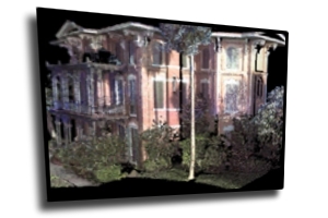
Ashton Villa

Historic Preservation Mapping, Galveston, Texas

      The Ashton Villa mansion was thoroughly documented by a team of field personnel from Grenland AsIs and GDM for the Galveston Historical Society. Documentation of this survivor of the 1900 hurricane was accomplished using a Leica HDS 3000 for the exterior and a Leica HDS 4500 and Basis Software Surphaser 25HS Hemispherical Scanner for the interior. The resulting data was used to make presentation materials for use in funding requests and will be archived for use in creating architectural plans should they be necessary in the future.

Forensic Mapping (Auto Accident), Texas

      GDM captured 750ft of highway including signage and a power pole that was struck during a traffic accident.  The collected data was used to create contour maps of the roadway surface. GDM then worked with forensic meteorologist and accident reconstructionist in order to determine the amount of water the roadway surface contained during the period of the accident.  The evidence produced by this project led to an agreed settlement and the dropping of the suit against our client.


Roadway Topography

  PAGE 1 2 3 4
HOME | SURVEYING |AUGMENTED REALITY | SCANNING | MEDIA | SERVICES | GEOSIM3D | FTP ACCESS | CONTACT | SITE MAP